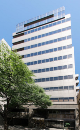
Online or onsite, instructor-led live Pix4D training courses demonstrate through interactive hands-on practice how to analyze image data and create 3D models with Pix4D.
Pix4D training is available as "online live training" or "onsite live training". Online live training (aka "remote live training") is carried out by way of an interactive, remote desktop. Onsite live Pix4D trainings in Nagoya can be carried out locally on customer premises or in NobleProg corporate training centers.
Nagoya is the third largest city in Japan. This open office is located in the district surrounding Nagoya station. Since 2015...
Nagoya is the third largest city in Japan. This open office is located in the district surrounding Nagoya station. Since 2015, landmark buildings kept inaugurating around the station and by 2017, it is predictable that many corporations will choose to be in this Meieki area. Furthermore, with the magnetic-levitated linear shinkansen to start service in 2027, Nagoya has strategic advantage.
Nagoya and Aichi area is known for its auto industry like Toyota. Besides automobiles, there are many head offices of Japanese manufacturers. With their affiliated companies and partners located in the same area, the city itself is a business complex. In recent years, forward-thinking IT companies are also trying to get a foothold in Nagoya. Besides all the attention-gathering news on the redevelopment, Meieki area has good access to Tokyo, Osaka and other major cities. It is also convenient for sales activity and commute. Therefore, it is a popular yet practical business district.
This instructor-led, live training in Nagoya (online or onsite) is aimed at field ecologists and conservation managers who wish to post-process Pix4D drone data.
By the end of this training, participants will be able to:
Implement Google Earth to enhance UAV mapping .
Use outputs of images to generate reports.
Post-process with GIS and CAD software for advanced drone data modeling.
This instructor-led, live training in Nagoya (online or onsite) is aimed at field ecologists and conservation managers who wish to land survey and drone map with Pix4D.
By the end of this training, participants will be able to:
Use end to end drone mapping processes and techniques.
Achieve high surveying accuracy.
Understand the fundamentals of global coordinate systems and GPS.
Generate and analyze survey output with Pix4D's image processing software.
Online Pix4D training in Nagoya, Pix4D training courses in Nagoya, Weekend Pix4D courses in Nagoya, Evening Pix4D training in Nagoya, Pix4D instructor-led in Nagoya, Pix4D trainer in Nagoya, Pix4D on-site in Nagoya, Weekend Pix4D training in Nagoya, Pix4D private courses in Nagoya, Evening Pix4D courses in Nagoya, Pix4D boot camp in Nagoya, Pix4D one on one training in Nagoya, Pix4D instructor in Nagoya, Pix4D classes in Nagoya, Pix4D instructor-led in Nagoya, Pix4D coaching in Nagoya, Online Pix4D training in Nagoya