お問い合わせを送信いただきありがとうございます!当社のスタッフがすぐにご連絡いたします。
予約を送信いただきありがとうございます!当社のスタッフがすぐにご連絡いたします。
コース概要
導入
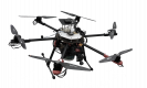
農業用ドローンの概要
持続可能な農業におけるドローン技術の活用
農業用ドローンの用途の探索
リモートセンシングを使用した監視
適切なドローンの選択
農場管理情報システム(FMIS)との統合
関連する法令と規制の学習
データ収集のための地形マッピング
利用可能なソフトウェアやツールを使用した飛行ミッションの計画
取得したデータの評価と処理
撮影された画像の分析
結果に基づく意思決定
まとめと結論
要求
- コンピュータサイエンスと工学の基本的な理解
対象者
- 農業技術者
- 農業研究者
- コンピュータおよび機械エンジニア
21 時間