日本、〒163-1030東京都新宿区西新宿3-7-1新宿パークタワー30階, 東京, 日本, 160-0023
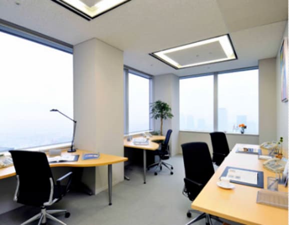
新宿パークタワーセンターのビジネスセンターは、新宿パークタワーの30階にございます。
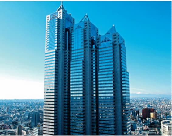
新宿パークタワーは、大規模な商業エリアと都庁を有する新宿西口のビジネス街に位置する、ランドマーク的な存在の52階建てのビルです。
西新宿には多数の超高層ビルが立ち並んでいます。新宿パークタワーは、西新宿の中でも屈指の高さを誇る超高層ビルの都庁から徒歩3分ほどの場所に位置しており、都庁と同じ建築家による設計です。センターの上階には有名な5つ星ホテル「パークハイアット東京」が入っています。
新宿には航空会社をはじめ、食品会社、大手テクノロジー企業やコンピューターゲーム会社など、数多くの企業が本社を構えています。リージャス新宿パークタワーセンターは最大60名を収容できる会議室を備えています。
「新宿駅」(世界で最も利用客の多い駅)から新宿パークタワーまで無料のシャトルバスが運行しています。成田国際空港へは「新宿駅」からリムジンバスおよびJR成田エクスプレスを利用することができます。お車をご利用の場合は首都高速4号線の「新宿」出口より約3分です。
渋谷グラスシティ, 〒150-0036東京都渋谷区南平台町16-28グラスシテイ 6階, 東京, 日本, 150-0036
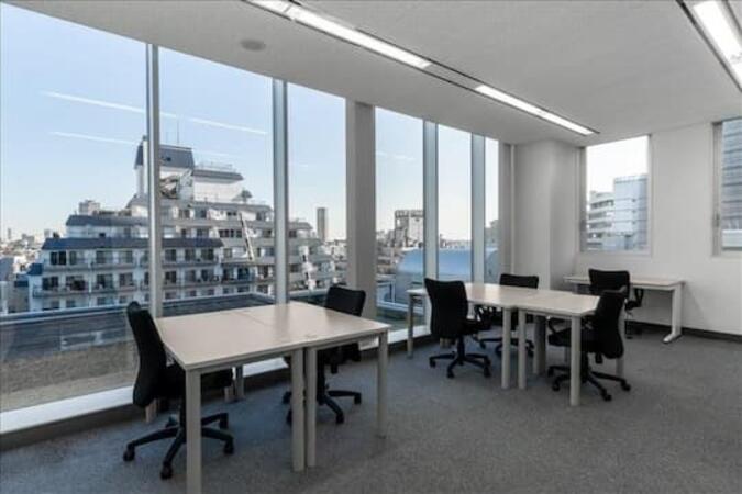
グラスシティ渋谷センターは、246と旧山手通りの交差点近辺神泉町の渋谷ガーデンタワーに隣接しているハイクラスビルの『グラスシティ渋谷』にあります。
表面がクリアガラスに覆われたデザインとなっており、遠目からもその美しいビルの外観を望むことができます。 2層吹き抜けのエントランスは開放的であり、ビル共用部分もゆとりがあります。 ビル自体の防音性能も高く、首都高速に隣接していますが、閑静なオフィスとなっています。
周辺は、渋谷、代官山、池尻大橋へのアクセスもよく、IT、デザインやマーケティングなどの最先端のクリエーティブな企業が集積している地域でもあります。 代官山や中目黒へも徒歩圏内。ベンチャー企業にとってもとても人気が高いエリアです。
近隣には、神泉や道玄坂上の個性的なレストラン、飲食店が多数点在し、 東急セルリアンホテルやエクセル東急と宿泊施設も充実しています。渋谷から徒歩圏の南平台エリアは、都内で最も人気の高いビジネスエリアの一つです。
リージャスのレンタルオフィスをビジネススタートに役立ててください。
東京のAerial Roboticsトレーニングコース, 東京の週末Aerial Roboticsコース, 東京の夜のAerial Roboticsトレーニング, 東京のインストラクターによるAerial Roboticss, 東京のAerial Roboticsプライベートコース, 東京のAerial Roboticsインストラクター, 東京の週末Aerial Roboticsトレーニング, 東京のAerial Robotics指導, 東京のAerial Roboticsクラス, 東京のインストラクターによるAerial Roboticss, 東京の夜のAerial Roboticsコース, 東京のAerial Robotics1対1のトレーニング, 東京のAerial Roboticsトレーナー, 東京のAerial Roboticsブートキャンプ, 東京のオンサイトのAerial Roboticssトレーニング